Still here …

image

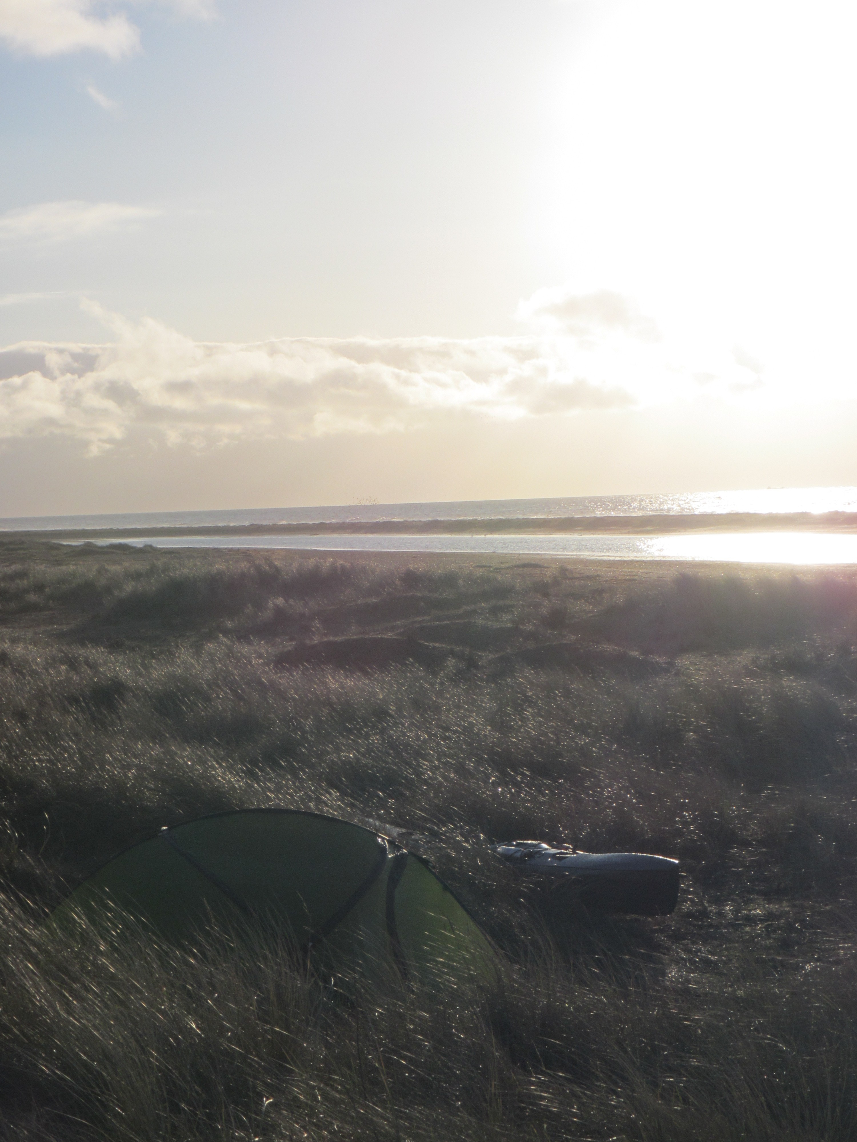
(Photo: The sun almost appears behind the Aldeburgh Scallop).

Well, I’m still in the same spot.  I thought I might paddle today, but the wind was stronger than forecast locally and the sea looked a bit rough, so I stayed on the beach. 

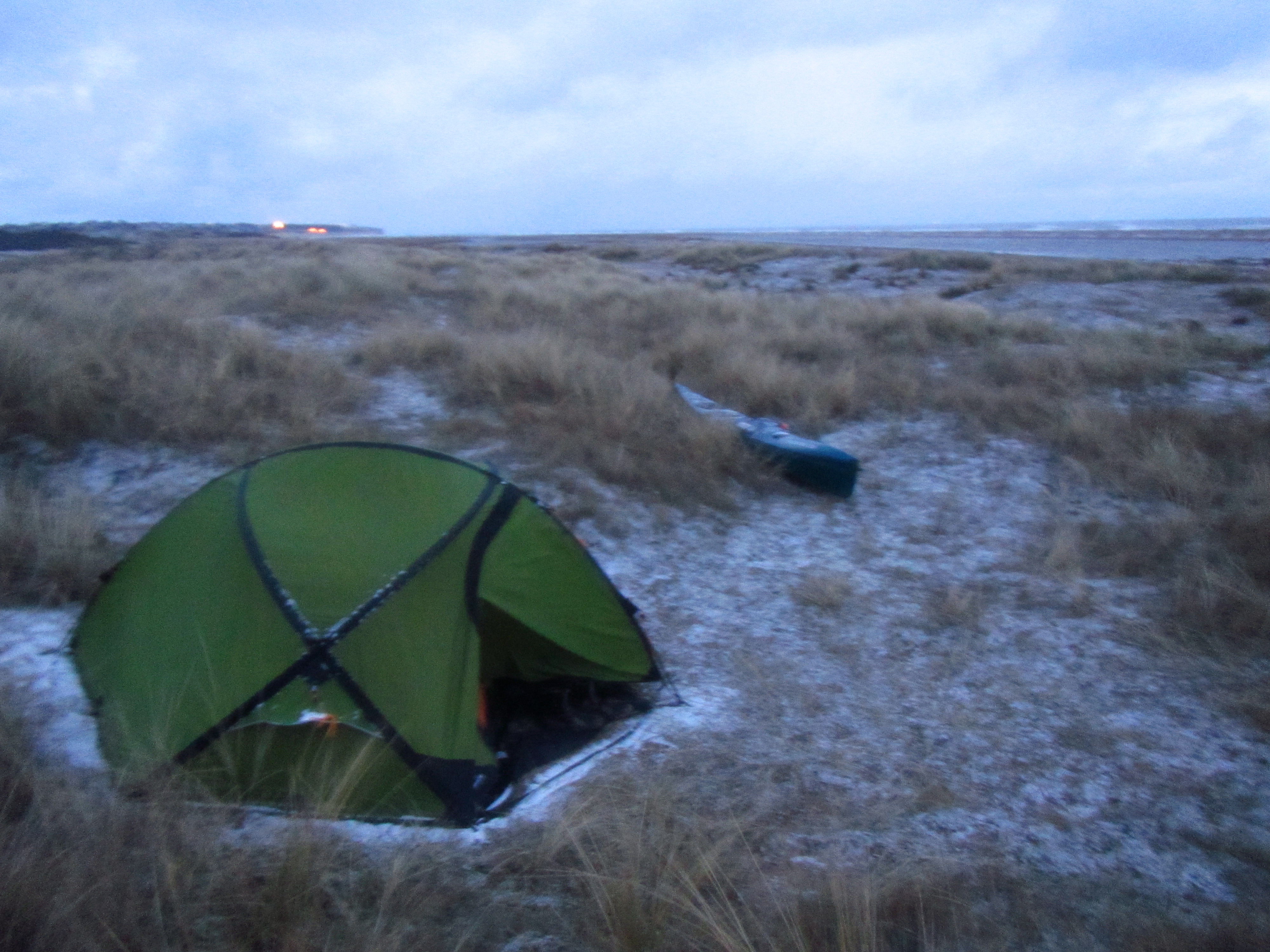
The steep shingle beach here has provided me some shelter from the easterly wind while camped behind it, but looks hard to leave while the waves are dumping on it.

I even thought about wheeling my boat to the other side of Aldeburgh, so I could paddle a few miles on the sheltered River Ore, but I think that would be cheating!

Aldeburgh is really quite a small place – I saw a lost hat yesterday, and I knew who it belonged to.

A tent pole broke last night, so I spent a while making a temporary repair this morning.  I hope it lasts until I can get a replacement.

Thanks to Tim who made a visit and shared some of his knowledge of this stretch of coastline – much appreciated!

Lighter winds are forecast for tomorrow, so hopefully I can cover some distance, otherwise it looks like I’ll have to abandon my plans to cross the Thames over Easter while the Shoeburyness/Foulness range isn’t being used.   Fingers crossed !

Sea State: Scary

This is what the sea looks likes this morning … it is now starting to snow.   I think I could be stuck here for a while as this strong easterly is forecast to continue well into next week.     (I’m currently thawing out with a hot chocolate in a cafe).

roughsea

A small weather window …

image

There was another very cold start to the day today with a thin layer of ice (and a frost) covering the tent and the boat.  However, it was sunny and clear, and looking at the forecast, this was one of the calmest places in the country (as shown by this wind forecast map from xcweather).

image

I paddled a few more miles, passing picturesque Southwold, and the less appealing Sizewell power station.  However with the cold easterly strengthening, I decided to stop before Orford Ness, and am now enjoying some shelter from the wind behind the steep pebble beach near Thorpeness.

Looking at the forecast, I could be here for a while!  I said goodbye to Yarmouth CG today as I passed into the Thames CG area, and I am finally south of my start point in Cambridge.  Nevertheless, its a bit worrying too think that at my current rate of progress, I won’t be able to complete this circumnavigation this year – hopefully my pace will pick up as the days get longer and the weather improves.

Further south …

image

Yesterday, I paddled south from California to Kessingland.  I was aiming for Southwold (with a thirst for Adnam’s), but after the usual  later-than-planned start, and having to spend a fair amount of time zig-zagging to avoid areas of breaking waves, I went for plan B and landed a bit south of Lowestoft.

Today, I had a day off as the sea looked even less inviting than the forecast suggested (and my hands needed a rest).  All this paddling and the cold had given me quite an appetite, so I have spent most my time here eating in my tent – only taking a break to go to the pub for a meal.

California Surfing

image

I’m now at California, a bit north of Yarmouth.   It was a lovely paddle yesterday with some sunshine and some swell but very light winds.  I had the company of plenty of seals that followed me for a while, and a porpoise playing in the waves.  There were also lots of seabirds which i’m terrible at recognising, bit I think one of then was a razorbill.

The landing was a bit dodgy though – I met fog just before landing and couldn’t see the beach (although I’d marked what looked like a nice beach to land on the GPS).  As soon as I turned onto a wave, I found the surf was dumping into the beach in front of a sandbar, and ended up dinging the bow of the Taran.  Oh well, I don’t think there is any damage that a bit of gel coat won’t fix.

Today feels a lot more wintry and it is raining, but I’m going to paddle south some more while the winds are light.

A few more miles …

image

I left Cley this morning and covered a few more miles, but once the tide stopped helping, the headwind made progress very slow, so I stopped at Mundesley.

I know Mundesley from paragliding, and am camped on the ‘lower takeoff’ here – its quite reassuring to go somewhere I’ve been before and know there is a sheltered patch of grass here to pitch my tent.

I passed the cliffs at Cromer today where I’ve also flown before, but it all looks completely different from the sea.

I would write more, but I’ve had to walk to the top takeoff to get a signal, and now its starting to rain.

The forecast has improved for tomorrow, so I’ll go while the going is good.

A few photos of the trip so far …


Setting off from the mill pond in Cambridge (thanks Will for the photo).


After a whole week stuck at Gore Point waiting for the weather to improve, I finally managed to paddle yesterday.

Today the wind is up again, so I’ve found a pub with wifi so I can upload some pictures of the trip so far.


The raging torrent that is the Great Ouse.

The weather has been pretty horrendous – two inches of rain one day, thick fog another, frosts on the beach, snow, gale force winds, horizontal hail …

The wind chill was enough to turn boiling water stone cold again in the time it took to carry my kelly kettle back to the tent!

Still enjoying it nevertheless.


I gave the sensitive Blakeley Point a wide berth yesterday, but many of the curious seals swam out to see me.  The warden said “At least you didn’t land a helicopter on it like that bloke from Jamiroquoi the other day”.

A horribly knee-deep muddy exit from the tidal river near King's Lynn.
A horribly knee-deep muddy exit from the tidal river near King’s Lynn.
Chilling in the dunes.
Pretty view, but also pretty cold.
Did I mention the cold ?

A bad start

Unfortunately, this trip has gone rather wrong before it has really started.   On arriving at the coast after paddling down the Cam and Ouse, my phone kept reporting, “No signal”, so I assumed that there was no network coverage.

hidden_in_dunes
My rather inconspicuous position in the dunes.

The forecast sounded terrible, but I didn’t phone the coastguard as all I could have told them at that point was that I wasn’t on the water and I had no plans to paddle for several days.  However, I did phone home from a landline, explaining the situation, and so I was more than a bit surprised when the coastguard turned up at my tent saying they had been looking for me.

It turns out that I was in coverage, but the phone had broken, and of course, with hindsight, I should have let the coastguard know where I was.  On or off the water.

I’m now carefully proceeding, ensuring the CG always know where I am, carrying three new phones on three different networks, and feeling very red-faced and disappointed that I have unwittingly become a drain on the resources of one of the charities that I had hoped to support during this trip.

On my way …

After some delays, I’ve finally set off. As I haven’t done any training this year, I’m taking it easy – I’ve been enjoying warm days paddling down the Cam and Ouse – paddling in a T-shirt yesterday. However, the nights have been pretty cold (as shown by the frost on my boat !)

image

Portaging round locks had been hard work as this requires emptying the boat before I can lift it out of the water. I’m currently waiting for the tide on the river near King’s Lynn, which should give me a bit of a boost as I paddle out into The Wash …